West coast storm
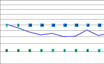
A strong frontal system crossing the coast into the British Columbia Interior tonight will bring strong winds and heavy precipitation to the area. Flurries are expected Saturday in the cool westerly flow in the wake of the system.
A series of frontal systems will bring more snow to the South Coast Mountains Sunday through Tuesday.
Tonight..Periods of snow.
Alpine low minus 9.
Snowfall accumulation 5 to 10 cm.
Freezing level lowering to valley bottom this evening.
Mountain top winds southwest 40 to 60 km/h.
Saturday..Cloudy. 60 percent chance of flurries.
Alpine temperature steady near minus 7.
Snowfall accumulation 2 cm.
Freezing level valley bottom rising to 900 metres in the morning.
Mountain top winds southwest 30 km/h.
Sunday.. Flurries.
Snowfall accumulation 5 to 10 cm.
Freezing level 1200 metres.
Monday.. Periods of snow.
Snowfall accumulation 10 cm.
Freezing level 1000 metres.
Tuesday.. Flurries Snowfall accumulation 5 to 10 cm.
Freezing level 1000 metres.


