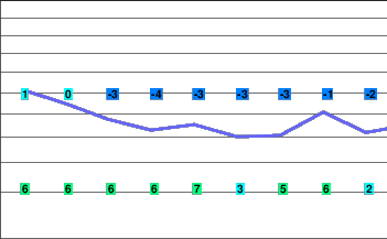
A ridge of high pressure
A ridge of high pressure will persist over the South Coast from today into Wednesday.
The ridge over the South Coast will break down late Wednesday allowing a Pacific frontal system to move across the region on Thurday. Behind the front a weak ridge of high pressure will build onto the South Coast on Friday giving some sunny breaks although unstable conditions will still result in flurries developing over alpine areas. Another frontal system will push onto the BC coast on Saturday.
Today..Cloudy with sunny periods.
Alpine high minus 1.
Freezing level 1500 metres.
Wind west 20 km/h.
Tonight..Cloudy periods.
Alpine low minus 4.
Freezing level 1200 metres.
Wind west 20 km/h.
Wednesday..A mix of sun and cloud.
Alpine high plus 3.
Freezing level rising to 2000 metres in the afternoon.
Wind southerly 15 km/h
Thursday..Periods of snow.
Snowfall amounts 5 to 10 cm.
Freezing level 1400 metres.
Friday..Mainly cloudy with a few flurries.
Snowfall amounts 2 to 4 cm.
Freezing level 1100 metres.
Saturday..Periods of snow.
Snowfall amounts 5 cm.
Freezing level 1500 metres.


