Increasing clouds
An approaching front will bring increasing clouds to the south coast mountains this morning. Some light flurries may fall today however the bulk of the precipitation is expected tonight.
Snow will taper to flurries Wednesday morning as the front moves inland. Another frontal system will approach the coast Wednesday night.
Precipitation from the next storm will start Wednesday night and continue through Friday as a front stalls over the Sea-Sky region. Significant snowfall amounts are anticipated in the Wednesday to Friday period.
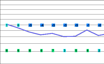
Today..Increasing cloudiness. Occasional light flurries developing late this afternoon.
Snowfall amount trace.
Alpine high minus 8.
Freezing level rising to near 800 metres this afternoon.
Mountain top winds becoming southeast 30 km/h this morning and gusting to 50 km/h this afternoon.
Tonight..Periods of snow.
Snowfall amount 2 to 4 cm.
Alpine temperature steady near minus 8.
Freezing level falling to valley bottom.
Mountain top winds becoming southeast 40 gusting to 70 km/h this evening then diminishing to southwest 30 km/h overnight.
Wednesday..Snow tapering to flurries in the morning then cloudy with sunny periods. Snow redeveloping late in the evening.
Snowfall amount 2 to 4 cm.
Alpine temperature steady near minus 8.
Freezing level rising to 900 metres in the afternoon.
Mountain top winds southwest 20 km/h.
Thursday..Snow and blowing snow. Windy.
Snowfall amount 20 to 30 cm.
Freezing level near 1000 metres.
Friday..Periods of snow.
Snowfall amount 15 to 25 cm.
Freezing level near 1200 metres.
Saturday..Cloudy with flurries.
Snowfall amount 5 cm.
Freezing level near 900 metres.


