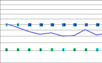
A break then more systems
A cool and unstable westerly flow will persist today.
Precipitation will taper off tonight as a weak ridge of high pressure builds towards the coast. A warm front will brush the south coast Thursday.
The trailing cold front will produce snow and wind on Friday.
Flurries are expected Saturday in the cool westerly flow in the wake of this next front. Another front will bring more snow on Sunday.
Today..Cloudy with a few flurries.
Snowfall accumulation trace to 2 cm.
Alpine high near minus 5.
Freezing level rising to 1000 metres.
Mountain top winds light westerly.
Tonight..Partial clearing.
Alpine low minus 8.
Freezing level lowering to valley bottom.
Mountain top winds light southerly.
Thursday..Cloudy with a few flurries.
Snowfall accumulation 2 cm.
Alpine high minus 6.
Freezing level rising to 1000 metres.
Mountain top winds southerly 30 km/h.
Friday..Snow. Windy.
Snowfall accumulation 10 to 15 cm.
Freezing level valley bottom rising to 1000 metres.
Saturday..Flurries.
Snowfall accumulation 5 cm.
Freezing level 1000 metres
.
Sunday..Periods of snow.
Snowfall accumulation 10 to 15 cm.
Freezing level 1000 metres.


