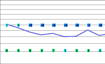
Increasing clouds Tuesday
A ridge of high pressure will remain stationary over the South Coast today maintaining dry and mild conditions. The ridge will weaken on Tuesday allowing a Pacific frontal system to approach the region. This system will bring increasing clouds and precipitation late Tuesday.
A series of Pacific disturbances will move across the South Coast through Friday bringing precipitation.
Today.. Sunny.
Alpine high plus 2.
Freezing level rising to 1700 metres this afternoon.
Mountain top winds light.
Tonight.. A few clouds.
Alpine low near minus 2.
Freezing level lowering to valley bottom.
Mountain top winds light.
Tuesday.. Increasing cloudiness. A few flurries beginning in the evening.
Snowfall amount up to 2 cm.
Alpine temperature lowering to minus 5 in the afternoon.
Freezing level rising to near 1300 metres in the afternoon.
Mountain top winds becoming southeast 20 km/h in the afternoon.
Wednesday.. Periods of snow.
Snowfall amount 5 to 10 cm.
Freezing level near 1100 metres.
Thursday.. Cloudy with 60 percent chance of flurries.
Freezing level near 1100 metres.
Friday.. Flurries. Windy.
Snowfall amount 5 to 10 cm.
Freezing level near 1400 metres.


