Late storm
A 990 millibar low is developing offshore and will approach later today / early tonight from the southwest. Ahead of the low southeast winds are forecast to develop off the west coast of Vancouver Island this morning rising to storm force this evening. By this evening, precipitation is expected through the Inner South coast as well good alpine snow accumulations overnight.
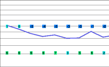
Freezing levels will be unseasonably low for the period.
A Pacific front will approach the region on Wednesday bringing wet conditions. Freezing levels are forecast to drop in the wake of the front on Thursday and Friday with flurries expected in the alpine.
Wednesday night.. Periods of snow.
Rainfall amounts 10 to 20 cm
Freezing level 1500 metres.
Thursday.. Cloudy with a few flurries.
Snowfall accumulation 5 cm.
Freezing level 1500 metres.
Friday.. Cloudy with a few flurries.
Snowfall accumulation 5 cm.
Freezing level 1500 metres.


